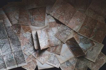
If you are wondering how to make an orienteering map, this article is for you. This article will give you an overview of the symbols, Scale, Paper used, and Software to make an orienteering map. By the end of this article, you will have an idea of how to make your own map and what to do with it. Orienteering maps can be very useful, so it is a good idea to read on to find out how to create your own.
Orienteering map symbols

There are several common orienteering map symbols. Some of them are coloured differently depending on their purpose. Those used for urban areas have a completely different set of symbols, while those for non-urban areas are the same. Open moorland is typically dark yellow. Orienteering maps are also accompanied by a key to help the novice find their way around the map. Listed below are some useful orienteering map symbols.
Control descriptions are also included on orienteering maps. These provide information to orienteers such as the heading and start location of each control. Often, these descriptions include the control codes that identify individual control flags. Control descriptions contain a list of control flags and their locations, allowing orienteers to easily confirm whether they have reached the right one. Some orienteers prefer to use the IOF Control Description Symbols to make it easier to find the control that they’re looking for.
Orienteering maps also include maps with legends that describe the meaning of the map symbols. Most orienteering maps have a legend to explain the symbols. Orienteering map symbols can be found in the downloadable guides produced by MapRunner. There are two main sets of orienteering map symbols: ISOM 2017-2 for regular orienteering maps and ISSOM Standard for large scale sprint maps.
Orienteering maps are extremely detailed, displaying areas five times larger than an OS map. These maps are more detailed than topographic maps, which are typically 1:25,000 or 1:50,000. The scale is a key concept for orienteering. One unit on a map represents seventy five units in real life. In orienteering, maps with an exaggerated scale make point features easier to identify.
Scale of orienteering maps
The scale of an orienteering map is important when using it for navigation. When you’re walking or running, you’ll need to track the distance to get to each control point. In addition to this, the scale also tells you the height of each control point and how many meters you’ll have to travel between them. You can use a handrail or another landmark to aid you in your navigation.
Orienteering maps are generally detailed and at one tenth the scale of a standard OS map. They also have more colours. Green and dark green mean dense vegetation, while brown and black are reserved for water and manmade features. To make sure you’re on course, it’s best to coordinate with a local orienteering club or a professional orienteering club before you set your course.
Orienteering maps are printed at different scales, depending on whether you’re navigating through city streets or the countryside. Orienteering races take place on different terrains, so the scales of orienteering maps are different too. While urban maps have a scale of 1:4000, woodland and moorland maps are more detailed at one:15-to-one ratios. The latter is better for orienteering in a densely wooded environment, because the map will tell you which way to go.
Orienteering maps are produced at a higher standard than normal maps. The corresponding colors on the map show different types of terrain. Some maps include the compass directions, which are used to navigate. Orienteering maps are also typically printed with different colors to help people use a compass. The angle between true and magnetic north is different in different regions of the world. These differences are important when you’re trying to navigate on an orienteering map.
Paper used
There are several factors to consider when choosing the paper to make an orienteering map. The type of paper, weight, coating, and other characteristics will all have a bearing on the final usability of the map. If you’re unsure of how to make a map, consider consulting the maps committee or orienteering association to obtain samples. Ideally, a map should be able to stand up to repeated creases and washing.
The most common paper used to make orienteering maps is paper that has been specially treated for use in orienteering. Orienteering maps are usually printed using magnetic north. Then, to use the map properly, you’ll have to adjust the base map to correspond to the map you’re using. After printing the map, you can then start surveying the area. Once you’ve mapped the area, you can create the final drawing in your own home.
If you’re making a map for a competition, you’ll likely need to use waterproof paper. Some orienteering events use Teslin, a waterproof paper that is often used for major orienteering competitions. However, you’ll probably have to order hundreds of sheets from BJBall to ensure you get a good supply. Other options include NeverTear, Standard Copy Paper, or XtraTear.
Orienteering maps are usually made of waterproof paper, but the new IOF rules for foot orienteering and other IOF sports require them to be protected against moisture. These maps are best printed on water-resistant paper, or sealed in a plastic bag. For a long-term solution, consider getting a map with a water-resistant coating or a transparent case.
Software used to make orienteering maps
The software used to make orienteering maps is often open source. The Open Orienteering Mapper is a free orienteering map-making program available for Windows, MacOS, and Android. Other popular software includes Condes, a course-planning and map-over-printing program, and Adobe Illustrator. There is also the National Grid magnetic variation angle calculator, which calculates the angle between magnetic north and the grid’s north. There is even a guide to printing maps in four colours, available for Linux and Mac OS X.
In addition to making maps, orienteering maps can be used to develop courses. The software also lets users design and create detailed descriptions of controls. It can also be used to design courses to guide competitors as they check Geo features. The software allows users to make notes about field features and create records. Using a graphical program to create an orienteering map is not as difficult as it may seem.
The open source ISOM 2017-2 symbol set is included with the latest version of OCAD. It has support for the ISOM 2017 control description standard. It is also compatible with Purple Pen and Condes. It is best suited for drawing new maps, but it can also be used to convert existing maps. Make sure to check your maps for errors before printing. If you are planning to use the software on a computer, consider converting your existing maps to ISOM 2017-2.
Orienteering maps are a vital part of a race. These maps should be as accurate as possible to help athletes perform at the highest level. The software used to create an orienteering map is essential for the race. It will help you create a complete map for your competition. The corresponding data and split times are recorded in WinSplits, which is an excellent program to use for orienteering.
Cost of making orienteering maps
If you are planning to create your own orienteering map, you may want to consider a few factors to lower the cost. First, consider the size of the finished map. Some commercial printers do not always print to standard paper sizes, so rearranging the layout or trimming the mapped area may save you money. Also, you should note that the Ordnance Survey has copyright on all their material, so any maps you create based on their material are in breach of their copyright unless they are licensed. However, if your map is based on photogrammetric base maps, this will not be a problem.
Making orienteering maps can be expensive, but many clubs pay for them through sponsorship and event fees. A major competition may have entry fees of $13 or $7 per day for senior competitors, while local club events may charge between three and eight dollars per person. Ultimately, the club will recoup these costs through running events on the map over many years. In the end, it’s definitely worth it.
Aerial photography is particularly useful when attempting to locate objects that are hard to identify. For example, aerial imagery can show boulders that are difficult to spot in a traditional map. Locating such objects is a fun hunt, but it requires sacrificing absolute positional accuracy. Nevertheless, if you use aerial imagery as your base map, it will save you a lot of time. If you’re planning to use the map for orienteering, you’ll want to make sure you have a high-quality map.
Another method for producing orienteering maps is to obtain a licence. The OS and BO have an agreement that lets them distribute their maps as long as they’re registered with the BO, and submit the necessary forms. In return, they receive a royalty based on how many copies the map is printed in a year. However, this is cheaper than obtaining a separate licence from the OS.
aeorienteering.com is reader-supported. When you buy through links on our site, we may earn an affiliate commission.


