There are many variations of Orienteering symbols. The British Orienteering ISSprOM symbol set was developed separately from the default OCAD set. These differences are subtle, but intended to improve legibility. For more details, see the ISSprOM symbol set file and pdf, which includes examples of British Orienteering variations and ISSprOM 2019-2 changes. If you’re planning to change your orienteering symbols, be sure to read the ISSprOM symbol set and make sure that you’re using the latest version.
Orienteering map symbols
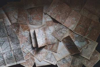
Orienteering maps are usually created in the perspective of a person walking. They are large-scale maps with more detail than topographic maps, which are usually scaled to 1:25,000 or 1:50,000. Scale refers to the scale of the world as a whole. One unit on a map is equivalent to about 7500 in real life. Orienteering map symbols tend to be more exaggerated, with black representing runnable forest, white representing manmade features and blue for water features.
Orienteering map symbols in the UK vary depending on the type of terrain. Non-urban and woodland orienteering maps use the same symbols as urban maps, while those in open moorland are darker. Orienteering map symbols are explained in a summary by Simon Errington in his book Orienteering Map Symbols: The Basics
Orienteering maps in the UK generally use a British orienteering-developed ISSprOM symbol set. The difference between the two sets is minor. The main change in British Orienteering’s symbols is a slight change in the order of colours, including CMYK values and overprint settings. The British orienteering ISOM 2017-2 sets retain the overprint mode for Purple and Brown, whereas the ISSprOM specification moves them down the colour table.
Orienteering maps are also based on Magnetic North. Unlike Ordnance Survey maps, which are based on the National Grid, orienteering maps use Magnetic North. Magnetic North differs according to time and geographical location. In the Preston area, for example, the magnetic north was about three and a half degrees west of Grid North. Hence, orienteering maps contain symbols in the form of arrows to help you navigate the course.
Orienteering control description sheets
Orienteering control descriptions help competitors locate the features of a control. Usually written in simple text, they are fixed to the map or available as separate sheets. These descriptions are more detailed as the difficulty of the course increases. They provide information about the size, location, and complexity of a feature. For example, a description of a hill, a tree, or a rock may be more complicated than a written description of the same feature.
An orienteering control is located within a control interval, which may be a line or a collection feature. Often, a collection point is less than two hundred meters away. Some orienteers also place a handrail in their course. Similarly, a route choice option allows orienteers to choose from several routes to reach the control. However, this method should only be used when there are no other features that can guide them to the control.
Beginners may want to learn the basics of orienteering by attending a local orienteering club’s beginners’ course. There, experienced coaches can tailor their instructions to meet the needs of the local community. Orienteering control description sheets provide the necessary information to ensure that beginners and intermediates alike can get the most out of the sport. For beginners, it is best to take about 15 minutes of instruction before beginning the course. Orienteering control description sheets should be included on the master map.
Orienteering control cards
Orienteering is a sport that requires you to collect and keep track of different pieces of information. Control cards are used to guide you through the course, so it’s important to have them. Control descriptions are written in black on white and are similar to the map symbols found on orienteering maps. Detailed information about each control can be found on the site. Orienteering control cards come with instructions on setting the controls and using a compass, which can make your experience a lot easier.
Orienteering control cards are used to track the location of a given control. Historically, control cards were used in North America. However, some countries have a stricter rule and only allow two punches inside the control card box. Therefore, you need to make sure to check the control cards for accuracy. Once you’ve made sure to punch the correct boxes, you’re ready to go.
Orienteering control cards come in various forms. They include numbered boxes where you punch in at successive controls and space for a competitor’s name, class and elapsed time. In most orienteering events, competitors start at a staggered order, so no two competitors start at the same time. Orienteering is a sport that involves self-navigating, so orienteering control cards are essential for the race.
Orienteering control descriptions
Orienteering maps contain a series of 5-color symbols known as map symbols that help the orienteer to locate the control features. The descriptions are printed on the maps or can be carried separately in a special description holder. The descriptions are normally written in simple language, but as the difficulty of the course increases, the descriptions become more complex. The following is a brief explanation of how to read the descriptions.
Orienteering control descriptions begin with a heading that lists the name of the event, class designations, course code, and length and height climb. The length and height climb are usually given in meters or kilometers. After the heading, there are lines that describe the individual controls or special routes. These descriptions use a grid of eight columns. The first column lists the number of the control, which is listed in ascending order.
The second column lists the distance to a control, its position on the map, and its description. Orienteering maps often include symbols for different types of controls. Orienteering maps use symbols that are similar to road map symbols, but are easier to read. Control descriptions are especially important because they help competitors visualize where the control flag is. An orienteering map will be more useful if it contains symbols for each type of control.
Orienteering control descriptions sheet
Orienteering control descriptions are used to help you find the features of controls along the course. Normally, they are printed on the map, but they can also be separate sheets that you can carry around with you. They are written in simple language, but as the difficulty of the course increases, so do the descriptions. To help you understand them, we’ve included some examples below. To learn more, visit this site.
Usually, orienteers will start at the attack point, which is a fixed point a few hundred meters away from the control. In some cases, there will be other linear features, but they should not be too far away. For example, a pit control should be at least 20 meters away from the start line. Moreover, a pit control shouldn’t be placed in dense forest, as this can make it difficult for the orienteer to find it.
Orienteering maps are extremely detailed, usually at a scale of 1:10,000. The scale is a bit more complicated than the one used by OS maps. The colors used for orienteering maps are not necessarily standard; they need to be learned. White space, for example, represents runnable forest. Black, on the other hand, represents manmade features. Other colours, like blue and brown, show landforms and water features.
Orienteering control description sheet
Orienteering control descriptions are important tools for finding and marking control features. They are typically printed on a map, or can be separate sheets carried with the orienteer in the field. Control descriptions are normally written in simple language, but can become more complicated as the difficulty of the course increases. For more information, check out this site. It has example sheets and explanations of each control description. This page will give you a brief overview of how to fill out an orienteering control description.
Orienteering control description sheets are confusing and sometimes difficult to understand. Since the sport is global, participants speak a variety of languages. International Orienteering Federation (IOF) has developed a system of symbols to identify each control location. Orienteering control descriptions will tell you exactly where the control is and how long it will take you to reach it. The IOF also recommends that the controls be located at decision points or raised points that can be seen from the path.
Orienteering control description sheets have various headings. The headings include the course designation, the length of the course (kilometers or meters), the number of controls and the overall distance. In addition, the descriptions include any obstacles that will cause the competitor to diverge from the ideal route. The description sheet also includes the “climb” of the course in meters. This is useful in identifying obstacles that may deviate the competitor from their intended path.
aeorienteering.com is reader-supported. When you buy through links on our site, we may earn an affiliate commission.


